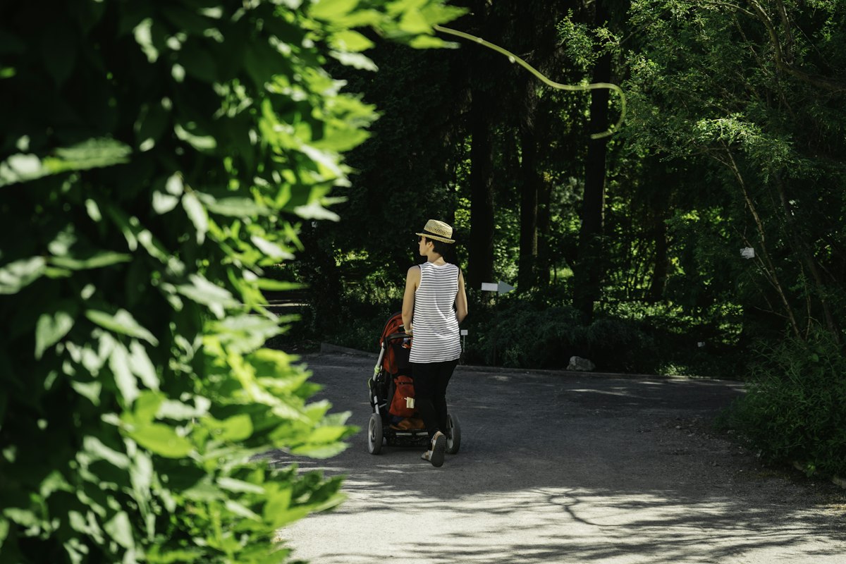
You have done the drive, found the trailhead, and pushed the stroller 200 metres before realising the "easy riverside path" is actually loose crushed stone the wheels sink into. This guide gives you a repeatable four-dimension screening method, a translation key for the words park websites love, and a way to pre-judge whether rain last night means the trail is still usable today.
The four-dimension screening method
A trail that looks fine on a map is only half the story. For a stroller (or a wheelchair, or a heavy off-road pram), passability is really four questions answered at once, in order of how often they kill a walk: surface, grade, width, facilities. Score each one from 1 (go home) to 3 (easy), and only commit to the drive if the total is at least 10 out of 12.
1. Surface (the deal-breaker)
Surface is the single biggest factor. In order of stroller-friendliness, from best to worst: smooth asphalt or concrete, compacted fine gravel (hardpack), boardwalk, firm mown grass, loose crushed stone, sand, mud, and anything with exposed roots or steps. A three-wheel jogging stroller behaves very differently from a four-wheel travel system; our Stroller & Terrain Match turns your exact pram model class and the trail surface into a go / caution / skip call before you pack the nappy bag.
A useful rule of thumb (经验值): if a trail advertises "gravel" or "crushed stone" without specifying "compacted", assume loose. Loose gravel wider than about 2 cm between stones forces every wheel to steer around individual rocks, and a fully loaded pram can weigh 20–25 kg — you will be pushing, not gliding.
2. Grade (what actually wears you out)
Even a perfect surface is unusable if it climbs. As a rough rule of thumb (经验值): under 3% average grade is easy for one adult; 3–6% is doable but tiring and requires braking downhill; over 6% on a stroller is effectively a no-go, especially with a travel system. To estimate grade from a trail map: divide elevation gain in metres by trail length in metres, and multiply by 100. A 2 km trail that gains 60 m is 3% — acceptable. The same distance gaining 150 m is 7.5% — pick another day or another trail.
3. Width (the social question)
A path narrower than 90 cm is a one-lane road. That is fine until a runner comes the other way at speed, or a wheelchair user needs to pass, or you need to let a group of school children through. Comfortable stroller width is around 1.2 m or more; boardwalks at city parks are often 1.5–2 m, which is ideal. Narrower paths are not forbidden, but they add stress and they are the reason many parents give up after one outing.
4. Facilities (the difference between nice and doable)
Facilities decide whether a walk is a nice morning or a logistics emergency. The shortlist: a toilet within 1 km of the trailhead (nappies on a bench are not a plan), a covered or shaded rest spot for feeds, a car park within pushing distance of the start, and ideally a loop rather than an out-and-back (so you can turn back early without retracing a steep hill). Our Rest Stop Planner maps exactly which trailhead facilities matter with a baby in tow.
Decoding the trap words
Park websites and review platforms describe the same trail with wildly different words. Parents on Reddit and wheelchair-user blogs keep compiling the same dictionary, because the gap between the label and the reality is where ruined weekend mornings come from. Treat the table below as your decoder.
| Word on the website | What it usually means | Stroller call |
|---|---|---|
| Easy | Short in distance. Says nothing about surface or grade. | Ignore as a stroller signal; ask the four questions. |
| Accessible / ADA-accessible | Officially meets accessibility standards — usually the best signal. | Usually go. Still verify boardwalk vs. asphalt. |
| Hardpack | Compacted dirt or gravel — but only when dry. | Caution after rain. Fine on a dry week. |
| Gravel / crushed stone | Often loose, 2–5 cm stones. | Skip for travel systems; caution for big-wheel prams. |
| Nature trail | Almost never paved; expect roots, ruts, steps. | Skip for strollers. |
| River path | Often flooded in spring or after heavy rain. | Check recent rainfall before you drive. |
| Loop vs out-and-back | Loop lets you bail early; out-and-back forces the same hill twice. | Prefer loops with little kids. |
Reviews are a better signal than official descriptions, but read them the same way. A five-star review from a runner is irrelevant; a review from a parent who mentions "we brought the stroller" or a wheelchair user mentioning "I did this in my chair" is worth ten times more. Sort reviews by most recent, because trail surfaces degrade — a path that was paved two years ago can be half broken now.
How rain and season change passability
The same trail is a different object in April versus August. Hardpack surfaces turn to mud within hours of heavy rain; a "compacted gravel" path in autumn is fine, in early spring it may be half underwater; boardwalks are the only surface that actually improves in wet weather because the wood drains. The pattern experienced parents follow:
- Check the 48-hour rainfall, not just the day you go. Anything over about 20 mm in two days means assume soft ground unless the surface is asphalt or boardwalk.
- Spring thaw and riverside trails are unreliable for 2–4 weeks after the last frost; even if it is sunny, the subsoil is saturated.
- Summer thunderstorms can turn a dry gully into a flowing creek in 30 minutes — do not push a stroller down a narrow ravine path if storms are forecast.
- Winter: assume any unpaved trail is muddy or icy unless you have explicit recent reports.
Combine this with our Weather Readiness Check on the morning of the trip — it tells you whether the forecast and recent conditions add up to a stroller-safe day.
A 5-minute pre-drive checklist
Before you load the car, run these five questions. If any answer is "no", pick another trail.
- Is the surface asphalt, boardwalk, or explicitly compacted hardpack? (No to loose gravel.)
- Is the estimated average grade under 6%? (Calculate it from the map.)
- Is the path at least 1.2 m wide for most of its length?
- Is there a toilet and shade within 1 km of the start?
- Has it rained more than 20 mm in the last 48 hours on an unpaved trail?
For the whole process in one place, start the Stroller & Wheelchair Friendly Trail Finder — it walks you through surface, grade, width and facilities as a short questionnaire and returns a shortlist you can actually drive to.
A stroller-friendly trail is not the prettiest one on the map. It is the one where you never once think about turning back because the wheels are stuck.
Pick the route, pack the nappy bag, and go. The goal is not a long walk — it is a calm one, repeated often enough that the kids grow up thinking the outdoors is their default place.